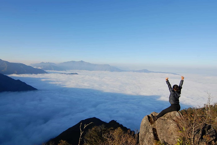
Muong Te Lai Chau is a province located north of Song Da, Lai Chau attracts tourists with many caves, roads and majestic natural scenery. The clearest proof of the majesty of this place is Muong Te Lai Chau – a small land with typical Northwest colors.
Where is Muong Te?
Muong Te is a district located in the Northwest of Lai Chau province, the northern border with Yunnan province, China. The terrain here is characterized by high mountains mixed with valleys, including many high peaks such as Pu Si Lung peak (3,076 m); Rich river systems flow through such as Da river, Nam Ma river..

Muong Te is an area with diverse terrain – @trunganh.fot0s
Muong Te district is home to many different ethnic people. Previously, Muong Te used to be the largest district in the country, now ranked only behind Tuong Duong district, Nghe An province.

Muong Te is home to many different ethnic people
When should you conquer Muong Te Lai Chau?
As a Northwest district, Muong Te has a typical climate of the Northern mountains, so you should choose to go in September and October when the rice season is ripe. The fields in Thu Lum and Ka Lang communes are famous spots to view ripe rice, the bright yellow color of the rice flowers captivates tourists or those who are passionate about photography.

Golden ripe rice floods Muong Te
You should also pay attention to the weather situation to avoid conquering Muong Te during stormy times. The roads here have not been expanded or built much yet, storms can easily cause landslides and rising river levels. dangerously high.

When traveling to Muong Te, you should carefully check the weather – @trunganh.fot0s
Destinations you should not miss in Muong Te
Pu Si Lung peak
Pu Si Lung peak is one of the three rooftops of Vietnam, located on the border of Vietnam and China, in Muong Te district, Lai Chau province and is also one of the high peaks worth conquering in Lai Chau. If you want to go to Pu Si Lung peak, you need to apply for a security permit at the border station to ensure absolute safety and security.
 Pu Si Lung peak is one of the three rooftops of Vietnam
Normally, tourists often choose trekking in Pu Si Lung, the higher you go, the colder it gets and each season will have its own beauty. Conquering Pu Si Lung peak is not easy because the road is quite steep and difficult, requiring a long journey. Those who conquer this high mountain require quite a lot of strength and perseverance, but what you get in return is guaranteed to be extremely worthy.

Great view on top of Pu Si Lung
Milestone 17 – upstream of Da River
Da River in China is called Ly Tien Giang River and is formed from two main tributaries, A Mac Giang and Ba Bien Giang, flowing together to form. Da River’s length is more than half of the area of Vietnam and the starting point of the main river flow is Da River upstream – Milestone 17. At milestone 17, Nam Nap stream flows in. This place also has many extremely majestic mountain and forest scenes for visitors to explore.
 Conquer milestone 17 – upstream of Da River
